

Phiên bản mới nhất
Phiên bản
1.2
1.2
Cập nhật
tháng 6 13, 2025
tháng 6 13, 2025
Nhà phát triển
OsmAnd
OsmAnd
Danh mục
Travel & Local
Travel & Local
Nền tảng
Android
Android
Lượt tải
0
0
Giấy phép
Free
Free
Tên gói
net.osmand.nauticalPlugin
net.osmand.nauticalPlugin
Báo cáo
Báo lỗi
Báo lỗi
Tìm hiểu thêm về Nautical Charts — OsmAnd
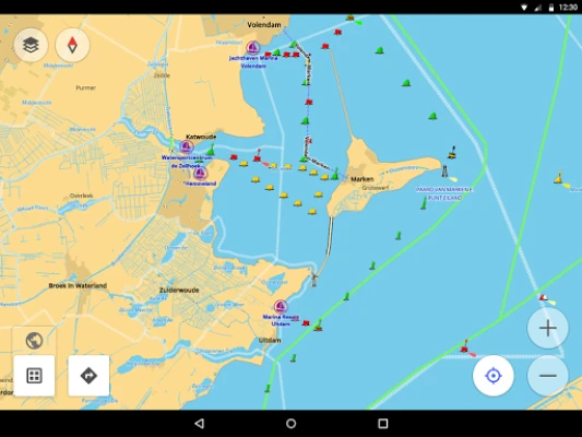
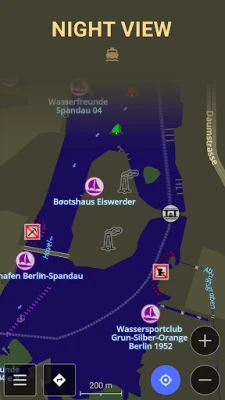
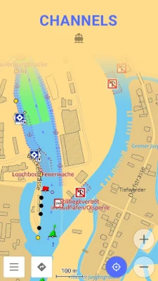
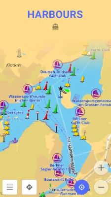
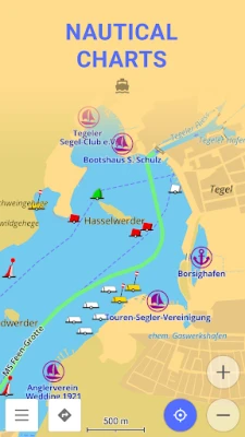
Nautical Charts — OsmAnd is an extension for OsmAnd Maps & Navigation app that provides free nautical charts for offline use. This sea map will be your reliable companion whether you are going fishing or planning a sea travel.
Nautical Charts are a detailed graphical representation of oceans, seas, coastal areas, and rivers. The charts can contain various information like sailing routes, navigation lights, dangerous areas, areas where it's allowed or not allowed to sail or dock, etc.
These maps are also supplemented with the information about the depth contours and nautical depth points that add valuable layers of data to the map.
All the professional sailors are obliged to have official marine charts
on their ships. These charts are published by authorized agencies and cost quite some money. Agencies are investing a lot in keeping the charts up to date. They release updates for the charts on a regular basis, but because of the fact that reviewing the information and processing the updates takes quite some time, the nautical charts are never completely up-to-date.
Nautical charts by OsmAnd are based on the data from the OpenSeaMap project. The idea of the project is to build the detailed map by people who actually use it. Every user of the map can contribute by adding changes to it making it more detailed and more accurate.
While OpenSeaMap charts at the moment cannot compete with official nautical charts, they can be used by recreational sailors for orientation or route planning. This plugin does not provide nautical navigation but it is your offline reference tool that can be used together with other navigational programs.
Usage Instructions: it is highly recommended to download nautical basemap in order to see the maps regardless of detailed map presence. Nautical charts are provided as a map and a special style, to switch style in OsmAnd please use the menu item 'Configure Map' on the map screen.
Đánh giá ứng dụng
Thêm bình luận & đánh giá
Đánh giá người dùng
Dựa trên 0 đánh giá
Chưa có đánh giá nào.
Bình luận sẽ không được duyệt nếu là SPAM, lạm dụng, lạc đề, dùng từ ngữ thô tục, công kích cá nhân, hoặc kích động thù ghét.


Xem thêm »

Ứng dụng phổ biến

ESET Parental ControlESET

Rakuten Viber MessengerViber Media

Simply Auto: Car MaintenanceMobifolio

ASICS Runkeeper - Run TrackerASICS Runner App Inc.

Lịch Âm 2025 - Lịch Vạn NiênXem tử vi hàng ngày

FacebookMeta Platforms, Inc.

Duolingo: Học ngoại ngữDuolingo

YouTubeGoogle LLC

AirDroid Parental ControlSAND STUDIO

VNeIDTrung tâm dữ liệu quốc gia về dân cư
Xem thêm »
Lựa chọn của biên tập viên

Adobe Scan: Quét tài liệu, ảnhAdobe

YouTube Kids 5Google LLC
YouTubeGoogle LLC
Duolingo: Học ngoại ngữDuolingo
VNeIDTrung tâm dữ liệu quốc gia về dân cư

Zalopay Thanh Toán Tích ThưởngZION JOINT STOCK COMPANY

ZaloZalo Group
FacebookMeta Platforms, Inc.
Rakuten Viber MessengerViber Media

WhatsApp BusinessWhatsApp LLC